700-540 Million Years Ago
The Birth of an Ocean – Neoproterozoic Era
Our geological story starts 700 million years ago in the Neoproterozoic Era, the final part of the Precambrian. At this time, there was one supercontinent in the Southern Hemisphere that we now call Rhodinia. The only parts of Ireland that were part of this continent were the island of Inishtrahull off of Co Donegal, part of the Mullet Peninsula in Co Mayo and the area south of Bray, including the Sugarloaf, in Co Wicklow.
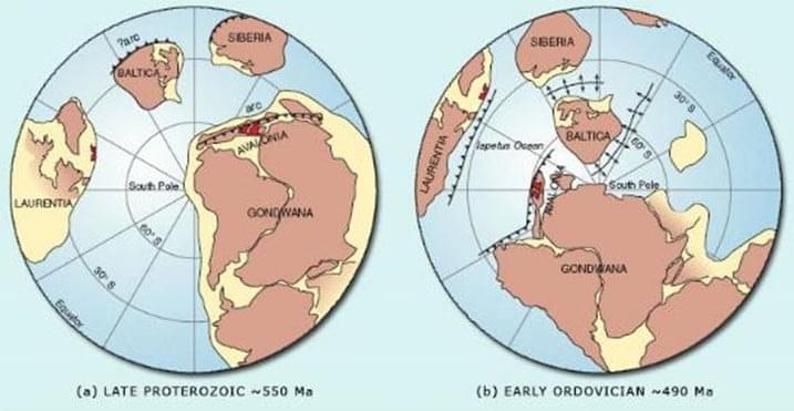
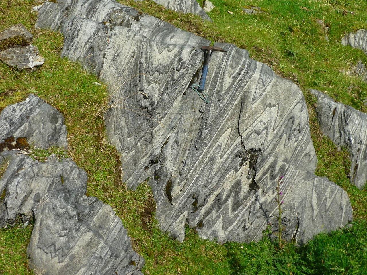
The supercontinent Rhodinia started to rift apart (i.e. fissures slowly opened up and divided the continent) and a new ocean called the Iapetus started to open around 590 million years ago. As the two continental blocks continued to move apart, magma erupted to form a new ocean floor and sediments such as mud, sand, and gravel were deposited and limestone formed.
We see rocks of this age in Ireland in both the southeast in Co Wicklow and Co Wexford and in the northwest in Connemara, north Co Mayo, Co Sligo, Co Tyrone, Co Donegal and Co Antrim. The rocks to the southeast are associated with a vast continent we call Gondwana and the rocks to the northwest are associated with a continent we call Laurentia.
Laurentia includes parts of Scotland (find out more on the North West Highland UNESCO Global Geopark website), Greenland, and Eastern Canada (find out more on the Cabox aspiring geopark website) whereas Gondwana includes parts of southern Britain, the eastern edge of North America and the whole of Africa, South America and Antartica.
In the Joyce Country & Western Lakes geopark region, we see evidence of rocks of this age from Corr na Móna westwards and from Cur Hill in the Maam valley to south of Maam Cross. Our internationally famous rock, Connemara Marble, started off as limestone at the centre of the new ocean floor. The soft Lakes Marble Formation of the Maam valley was once limestone and sand found in the shallow waters of the young Iapetus Ocean, and the tops of the Maamturks and the Twelve Bens were once sand from the continent deposited on this ocean floor.
490-360 Million Years Ago
The End of an Ocean – Ordovician to Devonian Periods
Volcanic island arc and subduction
Around 100 million years after its creation at the start of the Ordovician period (490 to 440 million years ago), the Iapetus Ocean started to close. The subduction of oceanic crust was responsible for the formation of a volcanic island arc. The subducted oceanic crust melted under very high temperatures and produced an influx of magma to the surface responsible for the formation of volcanoes. An analogue to this process is the modern volcanic islands of east Asia which are formed due to subduction zones in the Pacific Ocean.


Basaltic lava, with temperatures up to 1200°C, oozed onto the seabed and was cooled quickly by the sea water. We refer to this as pillow lava, because when seen in cross-section, the individual lava flows look like stacked pillows. This can be seen on the roadside in Finny, close to Lough Nafooey. Individual pillows are visible, as are vesicles or gas bubbles. Further north in Tourmakeady and slightly younger in age, there is evidence of another volcanic arc, this time made of lava that contains more material from a continental crust like silica minerals, evidenced by the presence of tuff, a rock made of volcanic ash.
Collision and intrusion of the magmatic arc
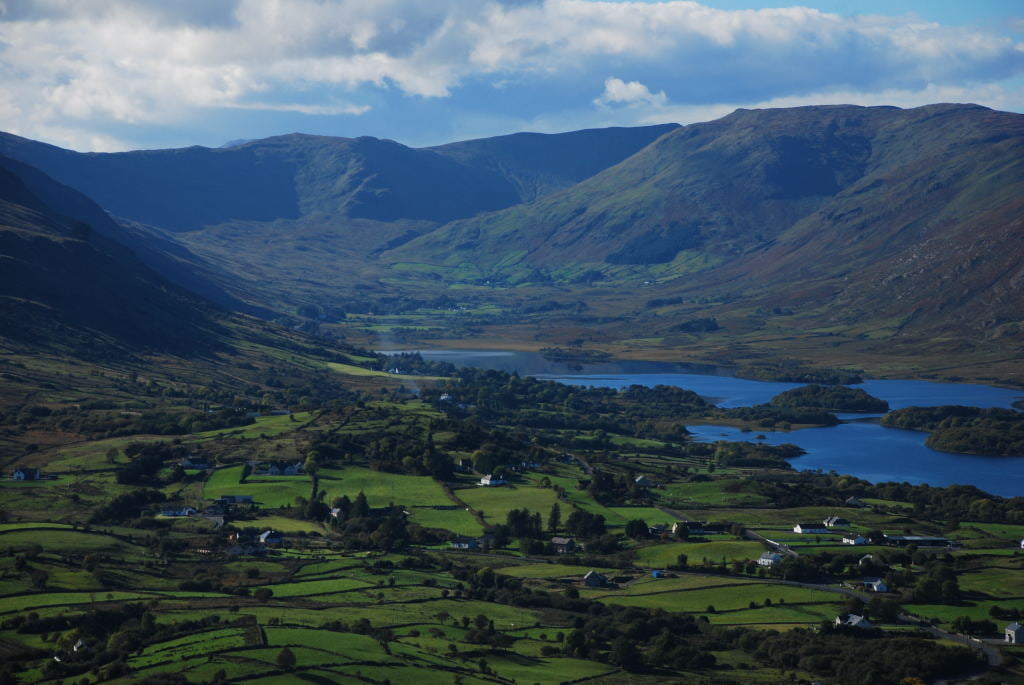
With the continuous closure of the Iapetus Ocean through subduction, the two ancient continents of Laurentia and Gondwana, and the volcanic island arc in between them, got closer and finally collided. This took place 475 to 460 million years ago and resulted in an enormous amount of deformation to the rocks that had previously been deposited over 200 million years earlier in the Neoproterozoic Era. These originally sedimentary rocks were metamorphosed (i.e. transformed) under those extreme heat and pressure conditions at depth and became metamorphic rocks such as schist, marble and quartzite. These metamorphic rocks are seen throughout north Connemara, e.g. the Maumturk Mountains and the area between Maam and Corr na Móna. Quartzite is made of a very high percentage of the mineral quartz, which is one of the more abundant but harder minerals found on Earth. This property gives quartzite a particularly strong resistance to erosion and the shape of the modern peaks of the 12 Bens or the Maumturks visible either side of Lough Inagh is a clear demonstration of this.


The townland of Cloghbrack got its name from the white speckles of quartz found in the local schist, as it means “the speckled stone” in the Irish language. The world-famous green Connemara Marble is found to the south of the geopark region where it has been quarried for over 200 years. Further examples of other types of marble can be seen at Cur hill or Corr na Móna where their folded internal structure testifies to the enormous forces that created them. These metamorphic rocks are grouped under the term Dalradian, a rock group which extends to Co Donegal and Scotland and whose rocks have the same origin as those found in our geopark region.
The collision process also contemporaneously gave rise to much wider scale deformation. The bedrock was folded into a large mountain range called the Caledonides (from the Latin word for Scotland), which could have been as high as the Himalayas today. Geologists named the formation of this mountain range, which extends through Scotland and Ireland as the Grampian Orogeny. This large-scale deformation occurred sequentially as the bedrock was folded once, then a second time and so on. Some of these folds are still clearly visible in the landscape and are seen by the wonderful viewpoints of the 12 Bens from the Inagh valley or of the Maumturks from the Maam valley. The complete documentation of this orogeny is one of the reasons why the Joyce Country and Western Lakes geopark region has geology of international significance; it is arguably the best international example of the complete Grampian-Taconic Orogeny.
The collision of the continental plates was accompanied by melting of rock at depth and of magma intrusion into the existing bedrock in chambers called plutons. These igneous intrusions occurred in the continental crust forming what is called a magmatic arc. Here, magma cools over very long time and because of this, larger mineral crystals form. These minerals are big enough to be seen with the naked eye. These igneous intrusions were also subjected to metamorphism, same as the rocks they were intruded into. This is case for the metagabbro and orthogneiss found south of Recess at Lettershinna Hill and south of Maam Cross at Glentrasna road.
Intrusion of the Oughterard granite
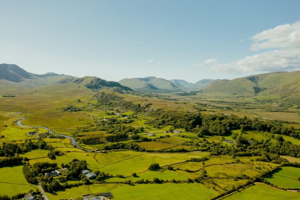
Towards the end of the collision process around 462 million years ago, the final part of the magmatic intrusion into the magmatic arc mentioned above formed the granite around Oughterard. As with the earlier part of the magmatic arc intrusion, the precise dating of the intrusions due to the radioactive elements present in the minerals, has been extremely useful to geologists. Indeed, the intrusion of the Oughterard granite has helped date the Dalradian rocks it intruded into, as it intruded in between specific folding events.
Docking of Connemara
An aspect of the geological history of the Joyce Country & Western Lakes geopark region that is particularly interesting is the fact that the entire region that comprises the Connemara Dalradian rock and its magmatic arc has moved in its entirety in relation to south Co Mayo. As discussed previously, these rocks are comparable to those found in north Co Mayo or Co Donegal. Our understanding of these rocks requires for their formation to have occurred when it was part of the Laurentian landmass located north west of what is now south Co Mayo. The whole block was detached from the rest of Laurentia around 468 million years ago and was subsequently thrusted (i.e. pushed laterally above other rocks) around 464 million years ago to finally dock itself in its modern position. This movement has been called the Mannin Thrust, as remnants of the underlying rock over which Connemara was thrusted outcrop in the area of Mannin Bay, south of Clifden.

Ordovician sedimentation in Co Mayo
The development of the volcanic island arc, its collision with the Laurentian continent and the formation of the Caledonian mountain range exposed a significant amount of bedrock which underwent weathering; a process which is still very much ongoing today. A large array of eroded sediments were deposited in south Co Mayo from Clew Bay to Killary and from the coast to the Partry Mountains. The eroded sediments included sand or gravels that were then deposited into river beds, estuaries, coastal and deeper waters. After deposition, the sediments beds were overlain by further sediments and the overlying pressure cemented together the sediments to form consolidated rocks. The resulting rocks formed from sand and gravel beds are called sandstone and conglomerate respectively. Sandstones and conglomerates make up the south Co Mayo mountains of Sheefry and Mweelrea, the Partry mountain range and Maumtrasna as visible at the Deircs and around Lough Nafooey.
Some of these rocks carry interesting fossil collections and assemblages. Fossils are important in telling us the history of life on Earth but also, they allow the relative dating of rocks by comparison with others elsewhere. In fact, a rare outcrop of shale (a specific type of mudstone) deposited in between two lava flows in Finny contains fossils that has allowed the dating of the volcanic arc described above. The palaeontological information (the types of fossils identified in which rock layer) gave geologists the first clues of the relationship of the rocks in north western Ireland with other rocks of the Laurentia continent in Scotland and North America.
Silurian unconformity
After their formation, the Ordovician sedimentary rocks of south Co Mayo were also folded by the on-going tectonic collision which folded the rocks in Connemara. This fold is evident in the angle formed by the various layers of sediments still visible in the bedrock either side of Maumtrasna; the angle of these beds is not the same when you look at the mountain from the east or from the west. We are not currently sure when exactly this folding process ended but we know it happened before the formation of the next sedimentary rocks in our geological history, in a time period called the Silurian (440 to 420 million years ago). We know this as Silurian rocks in direct contact with Ordovician rock appear deposited at a perpendicular angle to each other; this means the older rock beds were moved by the folding event described above before the sediments of the younger rock were deposited above it. When geologist find evidence like this in the field, they name it an unconformity and a general definition of the term is a gap in the sedimentary record. In other words, an unconformity means that there is evidence of erosion of the older rocks before the deposition of the younger ones. The best place to see this in our geopark region is between the summits of Bunnacunneen and Ben Beg.
The Silurian rocks come from sediments that were deposited in coastal to shallow sea conditions. The sea-level locally was getting higher and the sea inundated previously exposed sediments, a process geologists call ‘marine transgression’. The Silurian sedimentary rock succession that outcrops along the Finny to Kilbride road shows this change in sea-level. Sandstone appears first corresponding to coastal areas with high energy environments, where wave and tidal processes dominate. Then it is followed by shelly sandstone indicating shallow marine conditions where molluscs lived. As the sea got deeper, the conditions changed to lower energy environments and was characterised with the deposition of finer sediments like silt and mud, eventually becoming siltstone and mudstone. The fossil assemblages preserved in the local rocks from the Silurian Period are evidence of the rich biodiversity that existed around at the time. This was the subject of recent coverage by national media following the discovery of a new species of starfish from that era called Crepidosoma doylei in Tóin na Lí south of Leenane which was named after its discoverer Dr Eamon Doyle, the current geologist for the Burren and Cliffs of Moher UNESCO Global Geopark.


Devonian Galway granite
As the Iapetus Ocean finally closed at the end of the Silurian, the two parts of Ireland that originally formed in different continents became joined as one. During a time period called the Devonian (420 to 360 million years ago), a large amount of melting occurred locally which resulted in a vast intrusion of magma (dated at about 400 million years ago) that cooled beneath the surface and formed the Galway Granite, which is found all over southern Connemara. It is visible in contact with the older magmatic arc rocks of Connemara at Glentrasna road, south of Maam Cross.
The mountain building process that started in the Ordovician around 460 million years ago created a considerable mountain range. However over the course of 100 million years, erosional forces wore the mountain range down, as evidenced today by the plateau of Maumtrasna. In fact, the metamorphic rocks of Connemara and the Dalradian rocks only represent the roots of this mountain range that has since disappeared.
355-300 Million Years Ago
Connacht in the Tropics – Carboniferous period
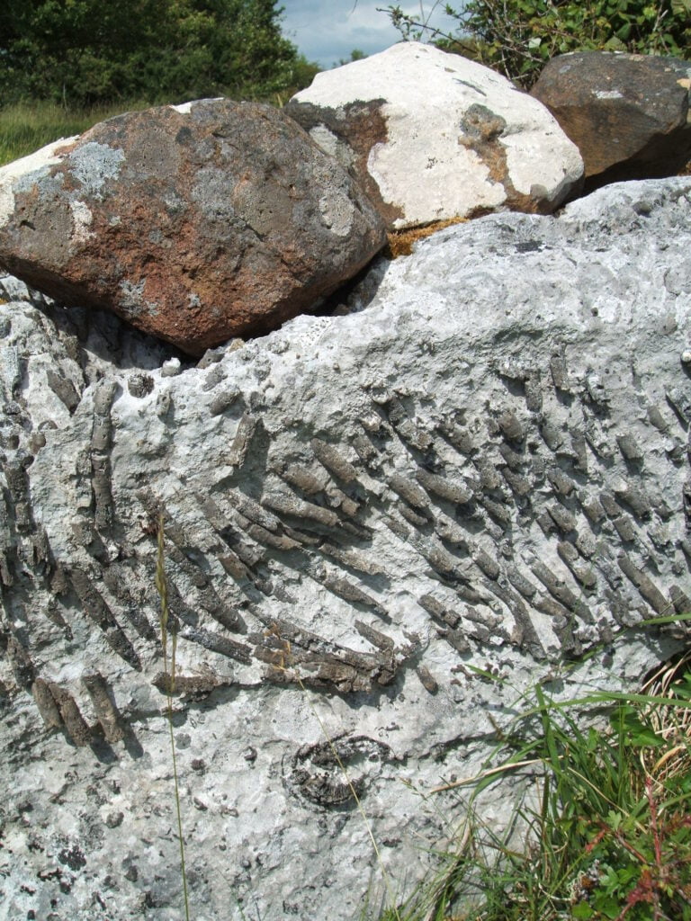
After this intense period of geological activity, the Irish landmass moved northwards during the Carboniferous Period, and from about 355 million years ago, was located at the Equator. Warm, coastal and shallow tropical water conditions, similar to the modern Great Barrier Reef both in terms of temperature and biodiversity, existed over most of Ireland. Geologically, this is recognised by the deposition of limestone. Limestone is composed of the skeletal and shelly remains of shallow marine organisms and microbes accumulated into a mud called micrite. The hard parts of these organisms, such as their shells, were in large part fossilised (i.e. buried and turned into minerals) and are still visible today in the limestone. When looking at the fossil assemblage, one can recognise corals (colonial or solitary), crinoids (from the same family as starfish), brachiopods (recognisable from their two asymmetric shells) and gastropods (snails).
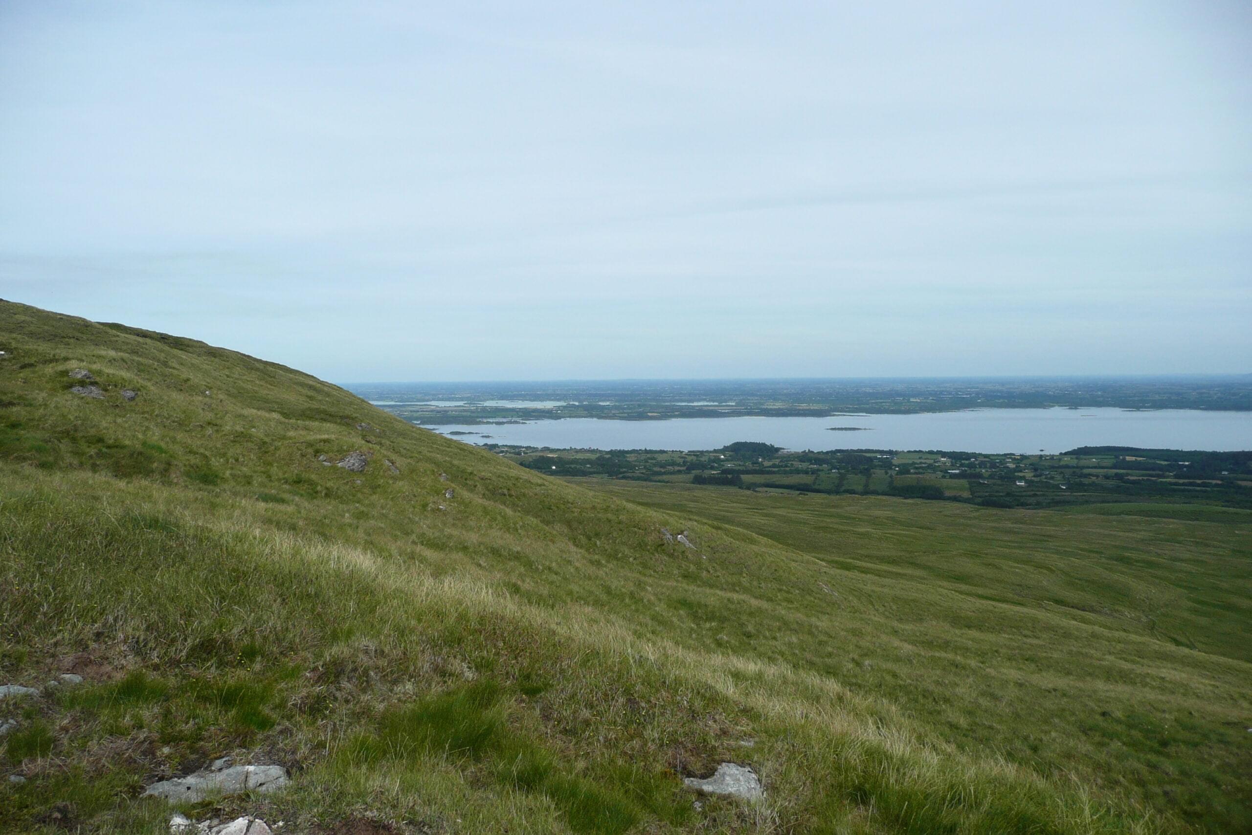
Limestone bedrock is widespread in Ireland, especially over the Irish Midlands. It makes up over 50% of the bedrock of the island of Ireland. In our geopark region, limestone bedrock appears to the east; entirely encompassing Lough Carra and most of the shores and lake beds of Lough Mask and Lough Corrib. Due to its abundance, Irish Carboniferous limestone is one of the main construction materials for field walls and houses and its distinctive dark blue colour is recognisable in buildings across the whole country, including the historical town of Ballinrobe.
300-66 Million Years Ago
The Last 300 Million Years – After the Carboniferous
There are no rock records in our geopark region for the following 250 million years. We know from other parts of Ireland that the landmass continued to move north, after colliding with another landmass to its south, which prompted some deformation of the bedrock and an uplift of most of the Irish landmass to a level higher than the sea-level at that time. As most sediments tend to settle and accumulate in basins, such as the seabed, the uplift of the Irish landmass above the sea-level meant that hardly any sediments were deposited in Ireland during these 250 million years.
Tectonically speaking, the next major event recorded in the geopark area was the opening of the Atlantic Ocean about 65 million years ago, at the end of the Cretaceous and the start of the Palaeogene Period. This started with the thinning of the continental crust followed by the opening of rifts.
Cracks in the bedrock were formed and were “plugged” by limited intrusions of magma in our geopark area, as seen by the dolerite sill on top of the Partry mountains at Droimchogaidh. This rifting activity that separated Ireland from Greenland and North America is also now thought to be responsible for the formation of the mountains that we see today in the west of Ireland. A section of Carboniferous sandstone that predates the Carboniferous limestone of Ireland is found on top of the Maumtrasna plateau, which sits 400 m above the sea level. The same sandstone is also found at a depth of 300 m below the surface around Clonbur. This indicates that the rocks west of Lough Mask and Lough Corrib were uplifted by about 700 m. This would have occurred when the early spread of oceanic crust pushed the two landmasses apart, which would have locally pinned blocks of bedrock against one another in a limited space and pushed them upwards.
66 Million Years Ago To Today
Ireland Under The Ice
Further sediments were likely deposited over the bedrock we can see today during most of the Palaeogene and Neogene periods (66 million years ago to today). However, for most of Ireland, we can only find record of sediments from the last 30,000 years. The main reason for this lack of record are the extensive glaciations that took place all over Ireland during the end of the most recent geological period, the Quaternary, which started 2.6 million years ago. As global climate was cooling, as evidenced in marine sediment core records and most importantly in ice core records, extensive ice sheets developed in the higher latitudes. These ice sheets responded to climate forcing that showed cycles of glacial and interglacial periods with warmer or even temperate conditions in the latter.
These cycles have settled to be about 100,000 years long with a short interglacial period compared to the glacial one.
We have very limited information of the penultimate glaciation in Ireland, but we do have extensive information of the last one, which was most extensive during the Last Glacial Maximum, about 24,000 to 21,000 years ago. Extensive amounts of sediments were deposited under the ice sheets and can be found throughout Ireland. These sediments are known as glacial till and are composed of sediments of different sizes, from mud and silt to sand or even boulders. These large fragments of rocks can be attributed to their region of origin and have allowed geologists to trace the movement of the ice. Sedimentary ridges of sand and gravel marking the edge and extent of the ice sheets were found on the marine shelf offshore, up to 150 km away from modern Irish shores. There is evidence of extensive weathering of the bedrock of Irish mountains with only a few areas around some of the peaks with loose sediments left in situ (known as block fields). All other loose sediments were carried away by the moving ice. This collection of evidence shows that at its maximum, the ice covered the whole of Ireland, most of the mountains (leaving only small peaks outcropping over the top of the ice) and extended up to 150 km offshore. This last ice sheet eroded the bedrock, shaped the landscape and carried away an enormous amount of sediments offshore.


